Davis County Deed Records
Davis County deed records document every transfer of real property within one of Utah's fastest-growing counties. The Davis County Recorder's Office in Farmington maintains these documents and makes them available to the public under the Government Records Access and Management Act. Warranty deeds, quitclaim deeds, trust deeds, liens, and easements are all part of the permanent land record. Whether you are buying property, researching a title, or tracing historic ownership, the deed records held in Farmington form the official chain of title for every parcel in the county. Davis County was established in 1850, giving its records a history that stretches back to Utah's earliest years of settlement.
Davis County Quick Facts
Davis County Deed Records and Utah Recording Law
Utah operates under a race-notice recording system. Under Utah Code Title 57, a document that affects real property must be recorded with the county recorder to be enforceable against later parties. Section 57-3-101 requires that deeds and other instruments affecting title be filed with the recorder in the county where the land sits. Once recorded, a document imparts constructive notice to the entire world under Section 57-3-102, meaning no one can later claim ignorance of its contents. An unrecorded deed, by contrast, is void against a subsequent good-faith purchaser who records first under Section 57-3-103.
These rules make recording critical. Every warranty deed, quitclaim deed, trust deed, lien, and easement that passes through the Davis County Recorder's Office becomes part of a permanent, searchable chain of title. Buyers, lenders, and title companies rely on that chain to confirm clean ownership before any transaction closes. Davis County deed records are public records under GRAMA, so any person can request access without needing to show a reason for the request. The Recorder's Office accepts documents in person and through electronic recording channels for qualified submitters.
Note: Recording a document with the Davis County Recorder does not guarantee the legal validity of the instrument itself; it only establishes the date and order of recording in the official index.
Using the REDI System for Deed Records
Davis County built the REDI (Real Estate Data Information) system to give property owners, title professionals, and the public a single point of access for land-related data. REDI pulls information from the Recorder, Assessor, and Treasurer into one integrated platform. Users can search by street address, parcel number, or owner name. Results show ownership history, assessed values, tax status, and links to recorded documents. Subscription accounts allow users to download document images and survey plats directly, which is useful for title research and due diligence on purchases.
REDI stands apart from generic county portals because it was designed specifically around the needs of Davis County's rapid growth. The county's population has climbed steadily since the 1990s, and the volume of recorded instruments has grown with it. The system handles that volume well, returning search results quickly even for busy corridors like Layton and Bountiful. Free public access covers basic ownership and parcel data. Paid subscriptions unlock full document images and bulk export tools that title companies and attorneys find indispensable during closing season.
The REDI portal provides integrated access to Davis County deed records, assessor data, and tax information.
Logging into REDI with a subscription account allows title researchers to pull full document images for recorded Davis County deed records without visiting the Farmington office in person.
Davis County Interactive Property Map
The Davis County Interactive Property Map layers parcel boundaries over aerial photography and topographic data so users can see exactly where a property sits on the ground. Clicking a parcel brings up ownership details, the parcel number, and links back into REDI for full deed record access. The map supports zoom levels from the full-county view down to individual lot lines, which helps when researching easements or shared boundary descriptions in recorded deeds.
Title searchers use the map to confirm legal descriptions written in older deed records. Metes-and-bounds descriptions from the 1850s and 1860s can be hard to place without a visual reference. The map's aerial layer helps locate monuments and natural features named in those early documents. The Utah GIS Parcel Data maintained at the state level complements the county's own interactive tool, offering statewide parcel downloads for researchers who need to compare data across county lines.
The Davis County property map overlays parcel boundaries on aerial imagery to support deed record research.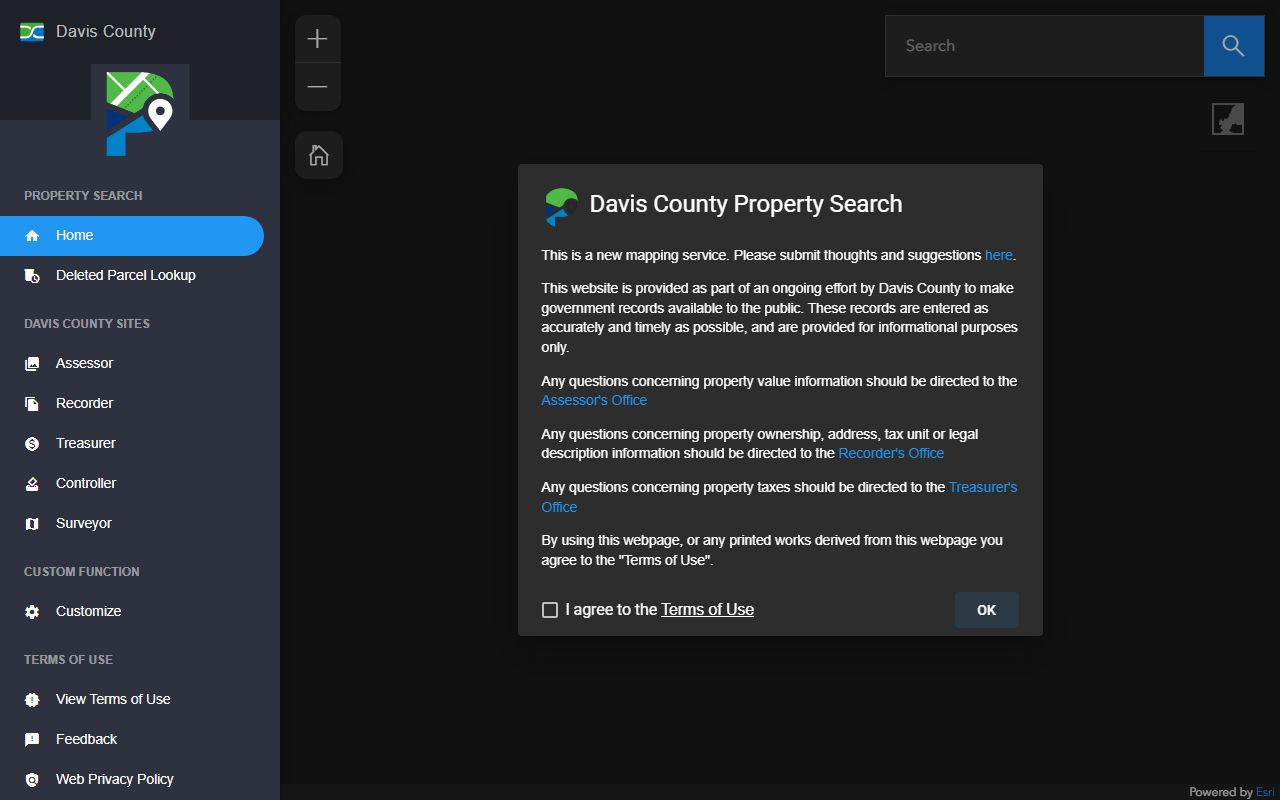
Property boundaries visible on the map correspond directly to legal descriptions contained in recorded Davis County deed records, making it easier to verify boundary information from older instruments.
Note: Parcel boundary lines shown on the interactive map are for reference only and may not reflect recent surveys or boundary adjustments recorded after the last data refresh.
Types of Deed Records Filed in Davis County
The Davis County Recorder indexes a wide range of instruments. Warranty deeds are the most common type recorded during standard real estate sales. The grantor in a warranty deed promises clear title and agrees to defend against any future claims. Quitclaim deeds transfer whatever interest the grantor holds without any warranty, making them common in family transfers, divorce settlements, and corrections of prior deeds. Trust deeds function as the security instrument for most mortgage loans in Utah; when a loan is paid off, a reconveyance deed releases the lien from the public record.
Beyond ownership transfers, the Recorder indexes liens, judgments, easements, and subdivision plats. Mechanic's liens protect contractors and suppliers who have not been paid for work on a property. Easements grant rights-of-way or utility corridors across privately held land. Subdivision plats establish the legal lot boundaries for entire neighborhoods and must be recorded before lots can be sold. Each of these document types appears in the REDI index alongside standard deeds, giving researchers a complete picture of encumbrances affecting any given parcel. Historical deed records from Davis County dating back to 1850 are also preserved at the Utah State Archives for territorial-era instruments that may predate the county's current digital index.
Davis County Recorder Contact Information
| Office | Davis County Recorder's Office |
|---|---|
| Address | 61 South Main Street, Farmington, UT 84025 |
| Phone | (801) 451-3222 |
| Online Portal | REDI Property Search |
| Recording Fee | $40.00 for standard documents |
| Electronic Recording | Available for qualified submitters |
| Certified Copies | Available upon request |
| Records Available From | 1850 (historical records at Utah State Archives) |
Related County Offices and Davis County Deed Records
The Davis County Assessor works alongside the Recorder to maintain a coherent property record system. While the Recorder tracks legal ownership through filed instruments, the Assessor maintains valuation records and classification data used for property tax purposes. The Assessor's data links to the same parcel numbers indexed in REDI, so a search on the portal returns both ownership and value information in one view. Primary residential exemptions and other relief programs administered by the Assessor can affect the tax status shown alongside deed record information.
The Davis County Treasurer's Office, also located at 61 South Main Street in Farmington and reachable at (801) 451-3243, holds tax payment history for each parcel. Unpaid property taxes can result in a tax lien recorded against the property, which will appear in the deed records index. Buyers reviewing deed records before closing should always cross-reference the Treasurer's records to confirm no outstanding tax obligations exist. The Utah Tax Commission provides additional context on property tax rules that apply across all Utah counties.
Water rights are a separate but related layer of property rights in Utah. The Utah Division of Water Rights maintains its own registry of water right ownership, which is distinct from the land deed records held by the county recorder. Some deed records, particularly older agricultural conveyances, reference water rights by share or priority date. Researchers should check both systems to get a full picture of what is being transferred in any given transaction.
Cities in Davis County
Davis County is home to a number of incorporated cities, each generating its own volume of deed records as property changes hands within city limits. The county recorder indexes all instruments regardless of whether the property sits inside a city boundary or in an unincorporated area. Cities in Davis County include Layton, the county's largest city, as well as Bountiful along the Wasatch foothills, and Syracuse on the western benchlands near the Great Salt Lake. Kaysville and Clearfield round out the major population centers, with Clearfield home to Hill Air Force Base and substantial residential development that keeps deed recording activity high.
Growth in all of these cities means the Davis County Recorder processes a large number of new subdivision plats and deed transfers each year. Anyone researching property in any of these communities can use the REDI portal to find current ownership and pull historical deed records without a trip to the Farmington courthouse.
Historical Davis County Deed Records
Davis County is one of Utah's original counties, established in 1850 just three years after pioneer settlement began. The earliest deed records reflect land grants and transfers among the first settlers, often describing parcels by natural landmarks and hand-drawn township lines. Many of these early instruments are preserved at the Utah State Archives, which holds historical deed records from all 29 Utah counties dating back to territorial days. The Archives provides access to records that predate the county's own digital systems, and staff there can assist researchers in locating older instruments by grantee or grantor name.
Federal land patents issued by the Bureau of Land Management also form part of the historic chain of title for many Davis County properties. The BLM Utah Land Patents database allows researchers to look up the original patent that transferred land from federal ownership into private hands. That patent typically marks the starting point of a property's private ownership chain and should appear at the top of any complete title search.
Note: Federal land patents are recorded in BLM's General Land Office records system and may not appear in the county recorder's index for older parcels.
Search Deed Records Now
Nearby Counties
Property research sometimes crosses county lines, especially along the Wasatch Front where urban growth has spread across multiple jurisdictions. The counties neighboring Davis County each maintain their own deed records systems.
View All 29 Counties